 A LIDAR Map is map that uses remote sensing to detect elevation. In this map it shows certain areas colored to determine where elevation is.
http://farm1.static.flickr.com/25/43339456_4168e661bc.jpg
A LIDAR Map is map that uses remote sensing to detect elevation. In this map it shows certain areas colored to determine where elevation is.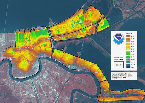
No comments:
Post a Comment